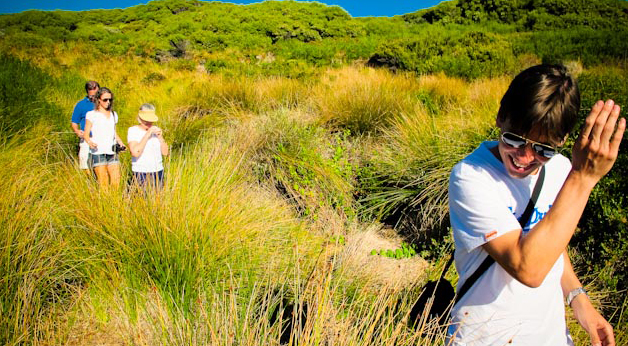
The Cape to Cape Walk Track is one of Australia’s greatest long-distance walk trail located in the far south-west corner of Western Australia, 250 km south of Perth. It meanders along the whole length of the Leeuwin-Naturaliste Ridge, starting and finishing at the lighthouses at the tips of Cape Naturaliste and Cape Leeuwin. The Track extends over 135 km of coastal scenery, sheltered forests and pristine beaches, and is in close proximity to the caves, vineyards and other features and attractions of the Margaret River Region (allow 7 days of walking).
The present Track is a combination of different types of terrain and surface. It varies from smooth, wide tracks, to narrow rocky paths, to soft sandy beaches and a few rough scrambles.
The Track includes several quite long stretches of accessible beach, allowing opportunities for cooling the feet. Many streams form sandbars in summer but flow through to the sea in winter. The only stream with a formal bridge crossing is Boodjidup Brook.
Access points along its length allow walkers to sample the Track as a series of short walks over some time. Many people actually complete the walk over several months or years as a series of one-day or half-day walks. The goal for some walkers will be to complete the whole Track at once, but for many, enjoying a short walk now and again is feasible.
Handy Hints
- You don’t have to do the whole thing. It is actually quite gruelling in parts so I generally recommend doing a 2-3 day section
- Walk south to north to ensure not walking into the wind
- Purchase Jane Scott’s excellent CTC guidebook http://www.capetocapetrack.com.au/ An ESSENTIAL purchase
- Think about doing a food and wine cache/drop somewhere along the walk. Eg Willyabrup cliffs. Make sure it is Possum proof
- Don’t rely on water tanks as they are often empty. Use town sites for re-filling
- Stop, look up and take in the view. Don’t rush. This is some of the cleanest purest air and landscape you are ever likely you experience
- Use Margaret River Designated Drivers as shuttle transport if using own car. Ph 0458 217 522 or email designated_drivers@live.com.au
- Hitchhiking on Caves Rd can be an easy way of returning to accommodation or vehicle at day end. This mode of transport has inherent risk and requires good judgement as you may end up drunk at the house of local winemaker
- Margaret River IGA make great meat/salad rolls for day hikes
- Book a Discovery Tour to get the most out of your experience www.margaretriverdiscovery.com.au
Cape to Cape Track marking
Square pine posts mark the way roughly every 100–200 m, each post bearing the yellow and white Track logo. Larger wooden signs usually show the way off beaches. But is essential to use a copy of Jane Scott’s excellent publication “Cape to Cape Track Guidebook”. Contact Jane on info@capetocapetrack.com.au
Climate
The climate along the Capes is not extreme, having a Mediterranean climate with warm, dry summers and cool, wet winters. Summer temperatures only occasionally reach the high 30s. This southwest corner – and Cape Leeuwin is the first part of the Australian mainland to feel the force of the Roaring Forties or winter gales that whip across the southern Indian Ocean. The minimum temperature is always above 0°C. It is generally considered best to walk in a South to North direction to avoid walking into the prevailing wind.
Camping
There are four low-key campsites for walkers wishing to camp out along the Track. These, together with existing campgrounds and caravan parks, provide places to camp roughly a day’s walk apart along the length of the Track. Each of the Track campsites has a bush toilet, a rainwater-tank filled from the toilet roof, a picnic-table, and seats. There are no shelters and walkers need to carry their own tents. There are no fees for using the campsites. Two other National Park campgrounds have toilets and fireplaces where camping fees are payable.
The Track passes through four settlements, Yallingup, Gracetown, Prevelly, and Hamelin Bay.
There is also a campsite planned for the Trigg Rd area in 2011.
Fire restrictions apply as this is amongst the highest rated fire risk areas in Western Australia. Carry a fuel stove and do not light campfires outside of the designated National Park campgrounds.
Water
The quality of water is highly variable, with creeks generally flowing from vineyards and farmland. All drinking water, except that from town taps should be treated. Don’t rely on streams because they dry up in summer.
In summer, walkers should carry a minimum of 3 litres of water for a day’s walking, and more if camping.
—————————————————-
Please note these tips are just handy hints and in no way represent official advice.

You will need to use your own initiative and good judgement to get the most out of your Cape to Cape Track experience.
Regards
Sean Blocksidge
www.margaretriverdiscovery.com.au
![]() About Margaret River Discovery Tours
About Margaret River Discovery Tours
Sean Blocksidge is the owner operator of the Margaret River Discovery Company, an avid photographer, blogger and South West WA ambassador. In 2010 he won Western Australian Guide of the Year and his tours have been rated the #1 thing to do in Australia on the Tripadvisor website for the past two years.
